Fire Mountain Au / VMS Potential Property
Available for Option
HIGH GRADE GOLD FOUND ON FIRE MOUNTAIN PROPERTY
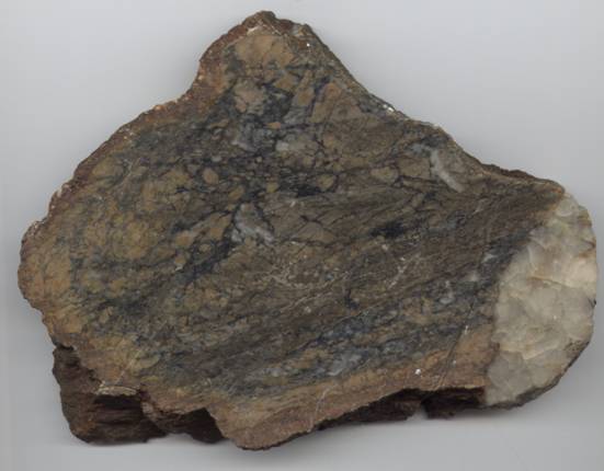
Drill core 980 meter north of Discovery site. Cut and Polished Sample from Discovery
site 189.0 g/t 5.52 oz/t Au and 40 g/t Ag
Encouraging Characteristics
nAntiformal structure increases prospective target length
nCored by possible subvolcanic intrusion, intruded into a bimodal sequence of dacite and basalt
nBimodal sequence capped by chert-exhalite unit that can be followed for 35 km around the antiform
nOverlain with structural disconformities by basalt and sedimentary strata
nDiscreet, intense alteration assemblages (garnet-chlorite, sericite)
nSeveral historic occurrences
Several highly brecciaed, angular boulders have been located in a small creek, 150 meter north of the Trans Canada Highway The boulders are strongly altered with ankerite, carbonate, silicification, quarts/tourmaline veining and contain 3 to 5% pyrite. An angular 30 kilogram boulder from this location also contained fine visible gold. assay analysis of this material returned assays of 91.2 g/t to 189.0 g/t Au and up to 40 g/t Ag.
Sample No. Au g/t Au oz/t Ag
95943 189.0 5.52 40.
558753 91.2 2.67 10.2
2155 172.1 5.02 no assay
Additional prospecting located a brecciated, altered, south dipping, northeast-southwest trending structure in bedrock located approximately 980 meter north of the discovery site. Although bedrock exposure is limited, alteration consisting of ankerite, carbonate, silicification quartz/tourmaline veining and pyrite is evident. To date, the zone has been traced intermittently for approximately 400 meters, has an apparent width of 30 to 40 meters, and remains open along strike in both directions. Several bedrock grab samples taken by Ministry of Northern Development and Mines Resident Geologist, Thunder Bay, Ontario returned gold values to 2.86 g/t Au.
The property lies within the productive Hemlo-Schreiber Greenstone Belt which hosts several world class mineral deposits including the Hemlo Gold deposit ( + 80 million tones at 7.7 g/t Au ), located approximately 60 kilometers to the east.
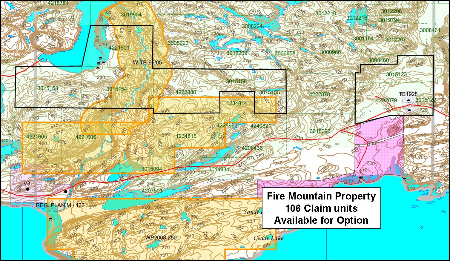
Fire Mountain Property location and claim map
The Fire Mountain property consist of 106 claims, 1,696 ha. and is located in the Tuuri and Walsh Twp. Thunder Bay Mining Division.
The float discover was followed up-hill to an outcropping zone of similar silica-albite-sericite-carbonate breccias with minor tourmaline and 1-4 % pyrite, possibly after original ultramafic rocks, within a broader zone of deformation and alteration from which samples of to 2.8 g/t Au were collected by Ontario Geological Survey (OGS) geologists (Mark Smyk). The exposed zone is at least 400 meters long and up to 30-40 meters wide. Other alteration zones consist of green-carbonate or "fuchsite" (mariposite) in a wider shear zone with abundant iron carbonate.
Review of the available information indicates that mineralization lies within a major regional-scale deformation zone identified initially in OGS mapping, with the property covering over nine kilometers of strike and 1,500 of width across-strike of the major splay-fault structures as they cut through a variety of more-or-less altered mafic and ultramafic rocks as well as gray wake-siltstone sedimentary rocks. The overall map distribution of various rocks display classical sigmoidal shapes as in volcanic rocks, felsic and mafic intrusive rocks as well as numerous planar to curvilinear faults and shear zones. There are extensive areas of carbonate alteration in both the sedimentary and mafic volcanic rocks, as well as more limited zones of silicification. Rocks identified on the available OGS maps as iron formations in fact consist of a variety of rock types favorable for gold mineralization which may be of structural-alteration origin including: (1) chert (tuff) with sulphides and minor magnetite; (2) sulphide-bearing sugar quartz and ribbon quartz; and (3) rusty weathering siliceous, graphite schist. The major part of the deformation zone lies along the regional amphibolite-greenschist (biotite-garnet) isograd. The area is intruded by granitoid stocks as well as felsic porphyritic bodies which are themselves show drag-folded outlines within the axis of the major deformation area.
The area has seen only limited exploration, although large parts were covered by claims and limited initial stage exploration following the discovery of the gold mineralization at Hemlo. The majority of the targets that were identified at that time were considered to be primarily for base metal massive sulphide mineralization similar to occurrences in the felsic volcanic rocks immediately to the north in the Steel River belt. A single 124.62 meter drill hole completed in February, 2003 tested the area of outcropping brecciated and altered bedrock located approximately 900 meter north-northeast of the high-grade float. It intersected an 11.83 meter long interval of brecciated and altered, (silicified, quartz-carbonate, sericite and albite) silstones, gray wackes and ultramafic rocks containing 2 to 5 % pyrite. The highest individual assay was 0.42 g/t Au over 0.80 meters widthin an overall anomalous section in Au of 45 meters in the drill core. No VLF, EM, MAG or IP where carried out on the property. This drill hole was drilled on the fact that we had anomaly Gold values in rock samples over 40 meters on surface.
If you interested in this Property then please contact me for more info.
